-
70%
-
51%
-
15%
-
80%3 Litres a Minute Flow Limiter for Bristan Taps $ 10.91 Add to cart This product has multiple variants. The options may be chosen on the product page
-
39%
-
24%
85%
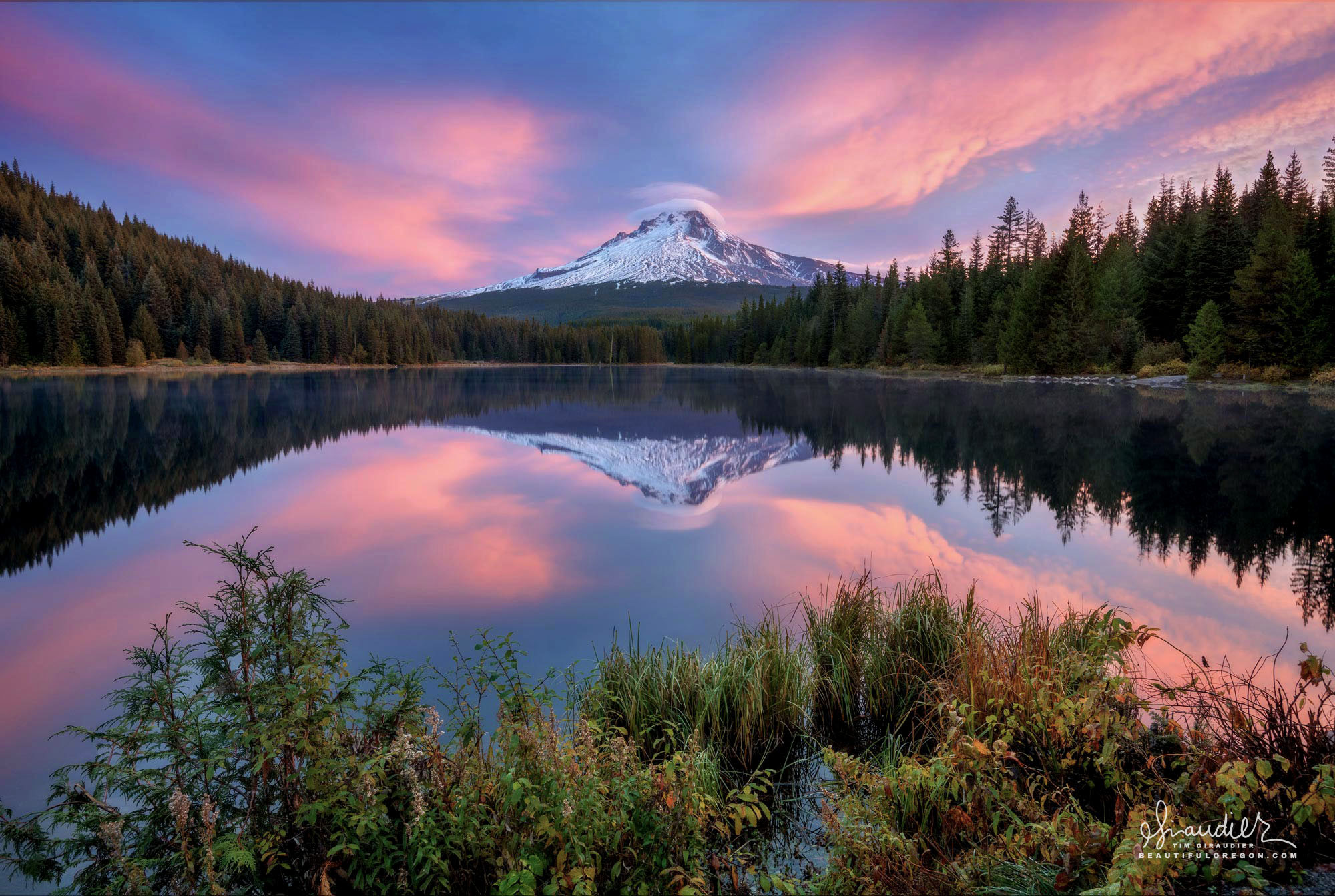
Mount Hood and Trillium Lake in Dawn’s First Light
$ 49.50
Save (85%)
‘X’ Marks the Spot: Trillium Lake and Mount Hood Long before dawn breaks over the crest of the Oregon North Cascades, the road to Trillium Lake is dark and quiet. Arriving in that pre-light stillness, there is nothing to do but wait — and then the sky begins to shift, softening through shades of pink as first light lays itself accross the mountains. On a calm morning, the surface of the lake becomes a near-perfect mirror, and Mount Hood appears twice: once rising 11,249 feet above sea level, and once descending in reflection upon stilled lake water. Sitting at approximately 3,600 feet in elevation within the Mount Hood National Forest, Trillium Lake covers 63 acres and maximum depth of 20 feet — a shallow basin by any measure. Above the summit, two small lenticular clouds hang like a cap over the peak. These lens-shaped formations are not drifting through — they are stationary, anchored in place by the aerodynamics of the mountain itself. As moist air is forced up and over the summit, it cools and condenses at altitude, then descends and evaporates on the lee side. The cloud appears static, but is in fact continuously forming on its windward edge and dissolving on the other, held in shape by the geometry of the mountain beneath it. Meteorologists regard lenticular clouds as reliable indicators of strong upper-level winds and significant atmospheric instability. The mountain that anchors this scene is a stratovolcano, built up over roughly half a million years through repeated eruptions of andesite and dacite lava. Its origins lie in the subduction of the Juan de Fuca Plate beneath the western edge of the North American Plate — the same tectonic process responsible for the entire Cascade volcanic chain. Mount Hood has not been dormant for long in geological terms. Its most recent eruptive period, known as the Old Maid episode, ran from the 1760s into the early 1800s, sending lahars down the Sandy River corridor whose fresh deposits were observed by members of the Lewis and Clark Expedition in 1806. Crater Rock, the prominent mass visible just below the summit, is the remnant of a lava dome extruded during one of these episodes, and fumaroles near it continue to emit sulfur dioxide and carbon dioxide today. Twelve named glaciers and snowfields persist on the upper mountain, their melt-water feeding the streams and wetlands of the broader watershed below. The lake itself is younger than its surroundings suggest. The glacially carved basin at this site was, as recently as 1960, an open marsh known as Mud Lake. That year, the Oregon Department of Fish and Wildlife dammed Mud Creek, a tributary of the Salmon River, creating the reservoir that now reflects the mountain so cleanly on calm mornings. Before the dam, and before the national forest designation, the ground at this site carried a different kind of traffic. The Barlow Road, the overland segment of the Oregon Trail that allowed immigrants to bypass the Columbia River, crossed through this area, and a log road over the marshy ground served westward-bound travelers passing through a toll station at nearby Summit Meadow between 1866 and 1870. For thousands of years prior, the region was home to Middle and Upper Chinookan peoples and the Molala, who hunted, fished, and gathered throughout these mountains. Clackamas County, Mount Hood, Mount Hood National Forest, Oregon Cascades, Sunrise, Trillium Lake
Related products
-
47%
-
45%
-
42%